Challenges and triumphs: remote wilderness to urban vibrancy
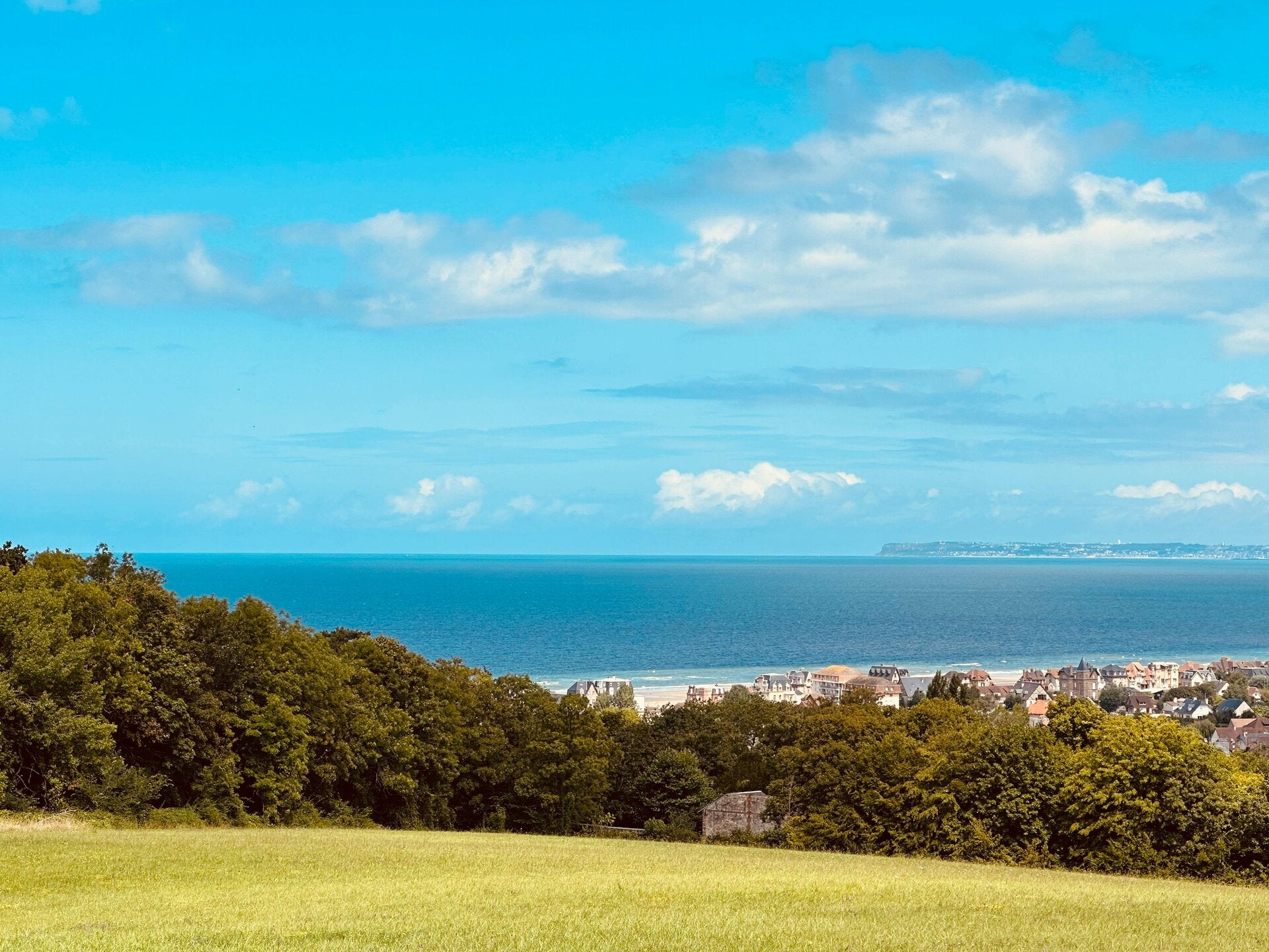
For John Merrill, this stage presented its own unique set of challenges and profoundly rewarding moments. Initially, the remoteness of the northern sections, especially up to Wick, offered a deep sense of solitude and connection with nature. This then gave way to the quiet, reflective stretches around the serene Moray Firth, where the pace of life feels slower. The final approach to Inverness brings the hustle and bustle of a city, a striking contrast to the vast, open landscapes. This transition from wilderness to urban environment encapsulates the diverse experiences of this 407-mile journey.
Turning the corner: a journey of transition
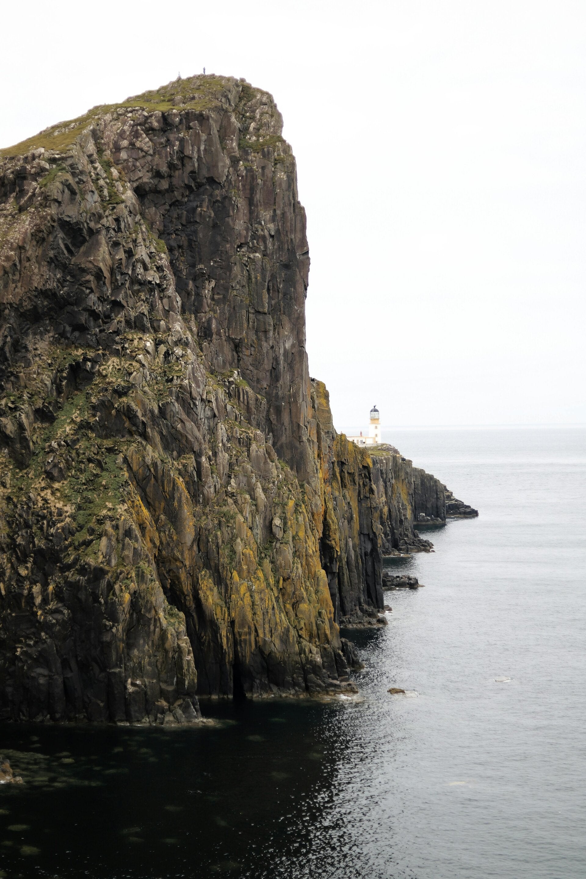
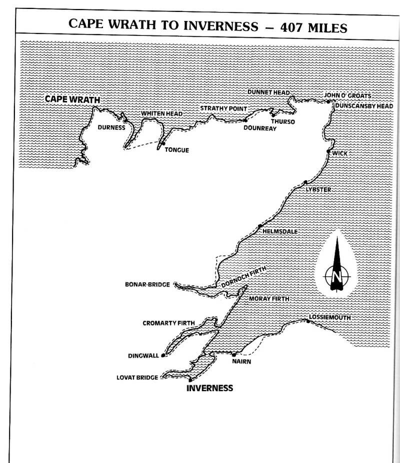
This 407-mile stretch of the British coastline walk marks a significant turning point in the epic journey. The most memorable aspect is undoubtedly "turning the corners" – first from the wild, untamed beauty of Cape Wrath along the north coast to the iconic John o'Groats. From there, the path begins its "descent" of the east coast of Scotland, offering a fascinating transition in landscape and experience. This stage encapsulates the shift from the remote extremes of the north to the evolving character of the eastern seaboard.
Stage SEVEN: Cape Wrath via John o'Groats to Inverness – 407 miles
Embark on the dramatic final leg of the northern journey with John Merrill. This 407-mile stage takes you from the wild beauty of Cape Wrath, around the iconic John o'Groats, and down the Scottish east coast to the historic city of Inverness. Discover the unique transitions, stunning landscapes, and personal reflections from this remarkable section of the 7,000-mile British coastline walk.
BASIC ROUTE -
187. Daill — Ferry Point — Kyle of Durness — Sarsgrum — Keoldale - Balnakeil — Balnakeil Bay — Faraid Head — Aodann Mhér
Durness —Smoo (Durness Youth Hostel} ...........................18 MILES ( 4,716 miles).
188. Durness — Samgobeg — Rispond — Souterrain — Laid — Loch Eriboll — A838 — Eriboll - Kempie— Hope — Loch Maovally -
Moine House— A838— Kyle of fongue—Tongue Youth Hostel ...................28 miles (4,744 miles).
189. Tongue Youth Hostel — Tongue Village — Tongue Youth Hostel — A838 — Moine House — Cnoc nan Gobhar — Freisgil! —
Whiten Head — Strathan — Talmine — Midtown — Melness — Kyle of Tongue — Tongue Youth Hostel ........ 24 miles (4,768 miles).
190. Tongue Youth Hostel — Rhitongue — Skullomie — Sletell — Suathan Skerray — Skerray—Airdtorrisdale — Torrisdale Bay —
Bettyhill — Farr —Swordly — Kirtomy — Armadale — Armadale House .................21 miles (4.789 miles).
191. Armadale House — Lednagullin — Aultiphurst — Aultivullin — Strathy Point — Strathy — Portskerra — Melvich — Bighouse —
Sandsite Head — Reay — Balmore — Bridge of Forss — Brims — Scrabster Loch — Scrabster ............. 28 miles (4,817 miles).
192. Scrabster — Thurso —Clardon Hill — Murkle Bay — Castlehill — Dunnet Beach— Dunnet ............12 miles (4,829 miles).
193. Dunnet — Loch of Bushta — Briga Head — Dunnet Head — Scarfskerry — Castle of Mey — Gills — Kirkstyle — Huna — John
o’ Groats Hotel ................................21 miles (4,850 miles).
194. John o’ Groats — Duncansby Head — Wife Geo — Skirza— Freswick Castle — Auckengill — Keiss — Tang Head — Keiss
Sands — Ackergill Links — Noss — Noss Head = Staxigoe — Wick Campsite ................23 miles (4,873 miles).
195. Wick — South Head — Castle of Old Wick — Helman Head — Sarclet — Mains of Ulbster — Ulbster — Whaligoe — Bruan —
Mid Clyth — Lybster — Forse — Latheron — Latheronwheel Hotel ...................22 miles (4.895 miles).
196. Latheronwheel — Dunbeath — Borgue — Berriedale — Badbea — Ord of Caithness — Navidale — Helmsdale Youth Hostel .................. 20 miles (4,915 miles).
197. Helmsdale — Portgower — Lothmore — Lothbeg — Dalchalm Beach — Brora — Strathsteven Beach — Dunrobin Castle —
Golspie — The Mound — Loch Fleet — Skelbo Castle — Coul Farm — Embo Campsite .............. 28 miles (4,943 miles).
198. Embo — Dornoch — Lonemore — Loch Evelix — Loch Ospisdale Skibo Castle — Whiteface — A9 — Spinningdale — A9 — Bonar- Bridge — Ardgay — Bonar-Bridge Station ........................20 miles (4.963 miles).
199. Ardgay — Kincardine — A9 — Ardvannie — Edderton — Tain — Balnagall— Inver — Roy’s Bay — Portmahomack..........................25 miles (4,988 miles).
200. Portmahomack — Hilton —‘Varbat Ness — Rockfield — Hilton of Cadboll — Shandwick — Hill of Nigg — Ankerville Corner —
Arabella — Ballchrargan — Kilmuir— Barbaraville — Balintraid — Saltburn — Invergordon............... 27 miles (5,015 miles).
201. Invergordon — Belleport — Alness — Novar—Evanton = Ardullie Lodge —.49— Dingwall — Maryburgh — Conon Bridge ............. 17 miles (5,032 miles).
202. Conon Bridge — Alcaig — Shoretown — Cullicudden — Balblair — Udale Bay — Jemimaville —Shoremill — Cromarty..................... 22 milwa (5,054 miles).
203. Cromarty — Sutors Stacks — Gallow Hill — Navitv — Ethie - Rosemarkic — Fortrose — Avoch — Crosshill — Drum —
Munlochy — Kessock Forest — Kilmuir — Craigton — North Kessock — Charlestown ............. 27 miles (5,081 miles).
204. Charlestown — Corgrain Point — Redcastle — Whitewells —Bellevue — Windhill — 49 — Beauly = Lovat Bridge — Kirkhill —
AQ — Mains of Bunchrew — Clachnaharry — Inverness .................. 24 milwa (5,105 miles).
Coastal contrasts: from rugged cliffs to tranquil shores
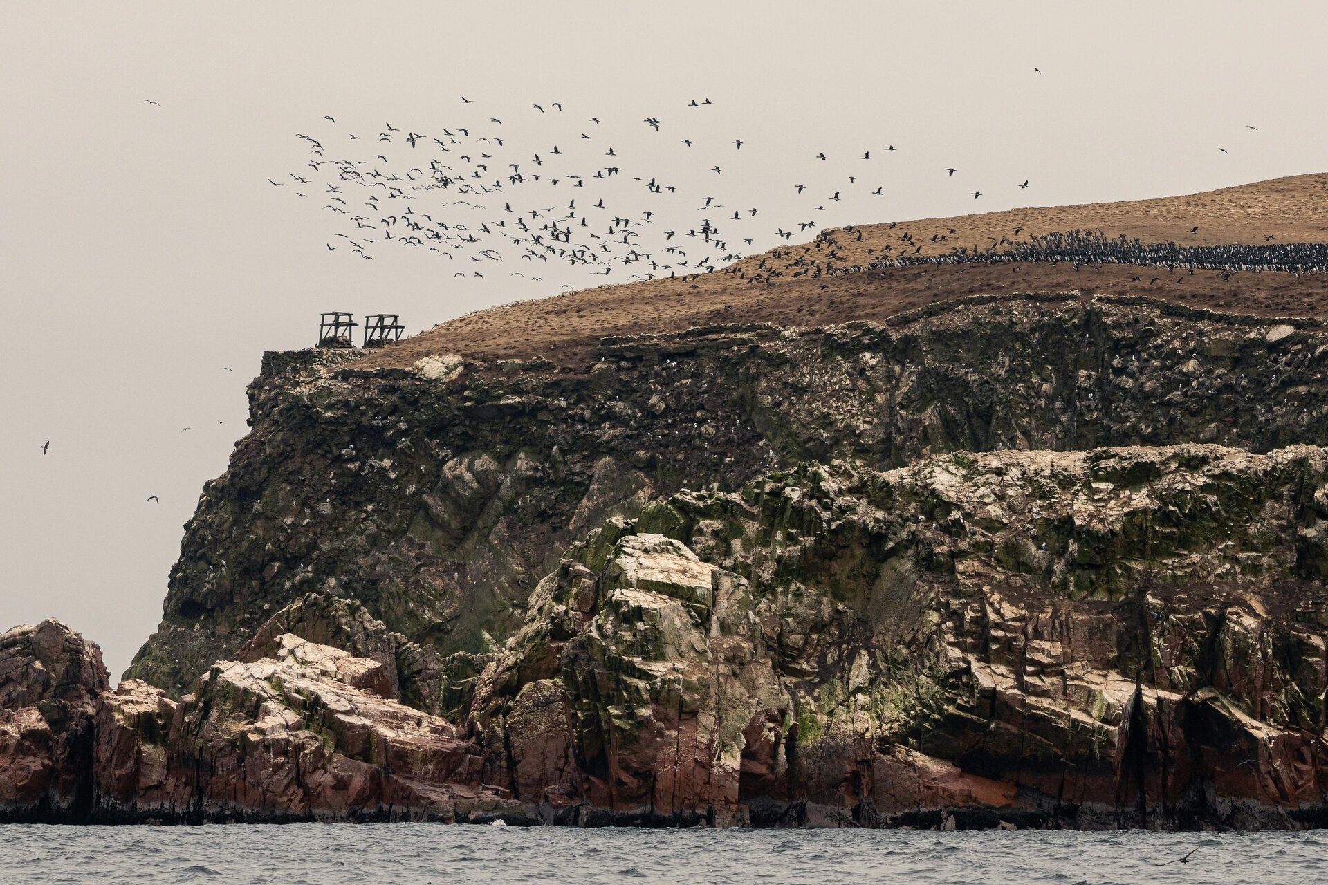
Stage eight offers a captivating blend of natural wonders. Initially, the scenery is rugged, particularly around places like Duncansby Head, where the dramatic cliffs meet the powerful sea. As the journey progresses towards Inverness, the landscape gradually softens, transitioning into gentler coastal vistas. Along this entire stretch, the cliffs are home to many seabirds, providing a vibrant display of wildlife against the backdrop of the ocean. Keep an eye out for guillemots, razorbills, and puffins nesting on the rocky ledges.